
Quatsino Sound, Quatsino - Kwakwaka'wakw Territory. Vancouver Island, British Columbia, Canada |
||||||

Quatsino potlatch figure, Royal BC Museum. Traditionally the Quatsino tribes spoke a single dialect of Kwakwala. They occupied the lands and waters of the far northwest corner of Vancouver Island, a remote area that was not invaded by Europeans until the last decade of the 19th century. European contact with the indigenous peoples of Quatsino Sound resulted in epidemics, large numbers of deaths, depopulation and displacement. By the 1880s there were four surviving tribes (right). Before amalgamating them in 1888, the Canadian government enumerated two of the Quatsino tribes as 17 Giopino and 13 Klaskino. |
Quatsino Territory. Five Kwakwaka'wakw tribes are represented by Quatsino First Nation: Giopino, Hoyalas, Klaskino, Koskimo and Quatsino. The "Place of Origin" for the Quatsino people is Xwatis (Hwates), in Quatsino Sound (above). Usurping authority under the Indian Act, the government of Canada forcibly relocated the people from Xwatis in 1972 to the Quatsino Indian Reserve near Coal Harbour. "Ready to Chop" is a figure carved in red cedar that was collected in Xwatis by a museum ethnologist in 1911 (left). It was used traditionally to simulate the splitting of coppers for canoes at potlatch ceremonies, an act that demonstrated the status of a chief who could afford to dispense with such valuable property and proclaimed a privilege of the Tsetseya family lineage. "Quatsino Sound tribes, c. 1880." |
|||||
|
Quatsino Sound and its people were essentially unknown to Europeans until 1868 when the Royal Navy gunship HMS Scout visited during the first circumnavigation of Vancouver Island by the colonial governor. Photos taken by the expedition's photographer include one of a village, perhaps Da'nade', showing its magnificent canoes, carved from whole cedar trees, in the natural harbour (right). Village of the Koskimo, 1876. |

Quatsino village, 1868. A photo taken in 1870 shows Koskimo people sitting on the beach in front of their village (left). Some of them are wearing Hudson's Bay Company (HBC) blankets which indicates trading contact at Fort Rupert. The photographer was documenting the second Royal Navy gunboat tour of Vancouver Island by colonial officials. The "Place of Origin" of the Koskimo is Gwúsi7, located at the mouth of Stranby River, north of Quatsino Sound. By the late 18th century, the Koskimo took over the former territory of the Hoyalas tribe and became the dominant tribe in Quatsino Sound. |
|||||

Quatsino Chieftainess and Chief Negetz. |
In 1881 and 1882 the director of the Museum of Ethnology in Berlin sent the Norwegian collector Johan Adrian Jacobsen to the hitherto undisturbed Koskimo and Quatsino communities. Jacobsen travelled by foot on a rough overland trail from Tsaxis (Fort Rupert) with George Hunt as a guide and interpreter. Jacobsen suffered physically from the strenuous trip and when he arrived at Xwatis he was given shelter and hospitality by Negetze, Chief of the Koskimo, whose name comes from the great boulder that hangs over Xwatis. Negetz and his daughter in law, the Chieftainess of Quatsino, are illustrated in Jacobsen's travel narrative (left). The collector describes how he was taken in under the protection of the "kind and gracious Quatsino Chieftainess, the most powerful person in the whole northwestern part of Vancouver Island." He wrote about how the generous woman even gave up her own bed so that he could sleep comfortably. At the same time, the unscrupulous collector used bribes to secretly rob the cemetery of his hosts and get his hands on some Quatsino skulls to send back to Europe for scientific study. |
|||||
To assist Jacobsen in his collecting activities, the Chieftainess and her husband, the younger Negetze, known as Wacas, accompanied him to another Quatsino winter village (probably Da'nade') where he "bought a number of rare and original items, among others the prized blankets of cedar bark, as well as one invaluable blanket of mountain goat wool." Jacobsen's success much depended on the translating skill of George Hunt, the 26 year old son of the Scottish fur trader at Fort Rupert and his Tlingit wife. Hunt later returned to Xwatis to collect Quatsino artifacts for Franz Boas, who greatly benefited over a period of some 30 years from Hunt's unique abilities. Among the many objects sent to Boas in New York in 1899 was an ingenious wooden frog marionette (right) for use during ceremonial dances. |

Quatsino frog marionette, c. 1899. |
|||||
In his travel account, Jacobsen describes how he returned to Fort Rupert in 1882 to arrange for a group of Quatsino and Koskimo "longheads" (as he called them) to accompany him back to Germany. Jacobsen sailed around the tip of northern Vancouver Island to Quatsino Sound where he convinced the Quatsino Chieftainess, her husband Wacas, two other women and a man to take part in his plan. Jacobsen offered seven HBC blankets to an adolescent female as a payment, but to no avail, as the parents of the young woman opposed the idea. So he left with just a small group of native people, but when his travelling party arrived back in Fort Rupert after enduring storms for 14 days at sea, they were met by a group of Koskimo who had made the gruelling overland trip from Xwatis to demand that Chief Wacas and his wife immediately return. Thus Jacobsen's German originating scheme to display aboriginal "longheads" in Europe failed. A carved wooden head used in Koskimo ceremonials was collected by Jacobsen in Quatsinso Territory and is today part of the collection of Berlin's Museum of Ethnology (right). The engraving in Jacobsen's book shows the sort of cranial deformation that was common among Northwest Coast tribes as a way to mark aristocracy and elite status. |

Engraving of a carved head. |
|||||

"Chief Kwa-hila," Xwatis, 29 August 1885. |
The Quatsino Sound tribes remained largely self sufficient during the 1870s and 1880s, with very few outsiders encroaching on their territories. A census taken in 1885 identified 145 Koskimo as living in 18 bighouses at Xwatis. Some of them, including Chief Kwa - hila, were photographed by the government of Canada geologist and surveyor George Dawson (left). Trading contact is evident from the Hudson Bay Co. blankets they wear and from the lumber used to construct the houses. In 1889, the Indian Reserve Commissioner for Canada visited the Quatsino Sound tribes and reported: "they have hitherto been brought but little in contact with the whites." On his advice, several small and inadequate reserves were set aside including the mostly Koskimo occupied winter village at Xwatis, which was identified as "Quattishe Indian Reserve No. 1." |
|||||
|
In 1894 the Koskimo were invited by the Kwakiutl to take part in their Winter Ceremonial at Tsaxis (Fort Rupert) with the 'Nakwaxda'xw. The sacred ceremonies were recorded in detail by the German ethnologist Franz Boas, who commissioned a leading German artist, Wilhelm Kuhnert, to paint a scene of the Koskimo hamatsas with their cedar neckrings (right). Wilhelm Kuhnert never visited Canada but he used photos by O. Hastings as visual documentation.
Hamatsa cedar rings collected in Fort Rupert. |

"Hamatsas of Koskimo," Tsaxis. Kuhnert's painting (above) was reproduced in Boas: Secret Societies of the Kwakiutl Indians (1896). Hamatsa neckrings made from red cedar were desirable objects for museum collectors. On the right: a) a medicine man's hamatsa, collected in 1881 by Adrian J. Jacobsen for Adolf Bastian, director of Berlin's Museum of Ethnology; and b) a hamatsa worn by the Raven of the Sea dancer, collected in 1901 by George Hunt for Franz Boas, at the American Museum of Natural History. The story of the scramble for Northwest Coast artifacts is described by Douglas Cole: Captured Heritage. Quatsino families and villages especially suffered from the plundering of their material culture. This loss became more grievous with the destruction of Jacobsen's collection at the Museum of Ethnology in Hamburg as a result of bombing during WWII. |
|||||

"Mrs. Tommy Clair and family," Quatsino, c. 1900. Mrs. Tommy Clair (above) was most likely from Xwatis (right). The photo of Xwatis captures the striking coexistence of the traditional way of life with some of the innovations brought into the native community by settlers. A carved welcome figure, the painted design around the door and the hand hewn cedar planks on the walkway contrast with the milled lumber and windows of the house, in front of which is standing a Quatsino woman and child dressed in European style clothes. From 1890 to 1920, during the period that salvage ethnographers such as Jacobsen and Boas were active in Quatsino Sound, the native tribes were undergoing profound changes due to the repressive Indian Act laws used to assimilate them into settler society. Tragically, three Quatsino tribes - the Giopino, Hoyalas and Klaskino - vanished and were declared extinct in the 20th century. |
At the same time that the federal government was coercing the indigenous inhabitants of Quatsino Sound to live on tiny reserves, the BC government was opening up their lands for European settlement and resource exploitation. In 1884, at the site of an ancient Quatsino village, Norwegian settlers founded a colony called Scandia just west of Xwatis (Quattishe Indian Reserve). Scandia was later renamed "Quatsino" and the first school in Quatsino Sound was built here. Although it was a public facility, native children were not permitted to attend the school. A photography studio was founded by the English immigrant B. W. Leeson. His portrait of the indigenous woman Mrs. Tommy Clair and her children reveals the pervasive influence of new clothing fashions (left). Xwatis, c. 1900. |
|||||

"Cas-e-lus, Chief of the Quatsino," 1912. |

"Village dance party," Quatsino, c. 1900. Turn of the century Quatsino dancers at a celebration in Xwatis were documented by B. W. Leeson (above). In 1912, Leeson photographed the Quatsino chief, called "Cas-e-lus" (left). This portrait was patented and copyrighted by Leeson as part of his commercial series of photographs entitled "Natives of Vancouver Island." The portrait of the Quatsino chief was later published in the opus magnum by Thor Heyerdahl: "American Indians in the Pacific" (1952). Here the Kwakwala chief is described as a "Kwakiutl legend bearer and public orator from Quatsino Sound." The same portrait of Chief Cas-e-lus appears as an iconic figurehead in the European First Nations website banner (top of screen, right). |
|||||

"Korpreno Tom," 1912. Traditionally the Quatsino Sound tribes hunted humpback and minke whales for food. Killer whales are an important part of Kwakwaka'wakw mythology and religion. A Killer Whale Society performs in the Winter Ceremonial tobacco, gun powder and white cedar bark are sacrificed to the killer whale as part of a prayer for food. |
Another photo by B. W. Leeson documents three inhabitants of Quatsino Sound in 1912 (left). A little boy in a dugout cedar canoe is being taught how to use a spear for hunting sea animals. The man is identified as Kopreno Tom, a member of the Giopino, or "people of Giopas" (Koprino Harbour). The Giopino came from a place near the north entrance to Quatsino Sound. When the Quatsino tribe moved into this area, the Goprino were driven away and moved into Koskimo territory, leaving only the skeletons of their bighouses which stood until 1950. Kopreno Tom was one of the last of the Giopino people. With his death in 1935, also the tribe became extinct.
Traditional design of a killer whale. |
|||||

Big house at Xwatis. |
Killer whale designs were also painted on big houses, such as the one at Xwatis (left). The same house was photographed by Edward Curtis. See: A Koskimo House in Vol. X, The Kwakiutl (1914) of The North American Indian. The Koskimo house belonged to a "numaym," or descent group, which traced descent from an original ancestor, usually in the form of an animal, and specific Place of Origin. The numaym was the basic social group in traditional society; numayms shared winter villages and used resources in adjacent areas. According to Boas, the 20 some Kwakwala speaking tribes were comprised of almost 100 numayms, each with a specific and complex set of ranked positions and privileges. |
|||||

"Yakotlus - Quatsino." Many of Leeson's studio portraits of the Quatsino and Koskimo people appeared in a series called "West Coast Natives," such as the portrait entitled "Lady Wacas" (right). She may have been a relation to Chief Wacas, who had acted as host to Adrian J. Jacobsen c. 1881. The same woman, this time unnamed, appears in The Kwakiutl (1914) by E. Curtis. See plate no. 354: Koskimo Woman. |
Photographs by Edward Curtis greatly contributed to the white perception of the North American Indian as a vanishing race. In his 1914 volume on the Kwakiutl, Curtis included two plates of a Quatsino man: Yakotlus (left). This may be Chief Cas-e-lus, seen in an earlier 1912 photo by B. W. Leeson above. Kwakiutl photographer David Neel condemns Edward Curtis for his hypocritical and unethical attitude in relation to his Indian subjects: "At the same time that the culture and people were being systematically uprooted, [Curtis catered to the] need for images affirming primitive humanity in touch with the natural world" Our Chiefs and Elders (1992). "Lady Wacas," c. 1912. |
|||||

"Wacas and Wife," 1920. In 1889, the ancient Quatsino village of Sipaya (Winter Harbour) was alloted as "Grass Point Indian Reserve No. 13." In 1901, a government enumeration recorded 25 Quatsino people living in nine houses in Sipaya. Ethnologist Edward Curtis identified Sipaya as the native village of the Quatsino between 1910 and 1914. In 1911 the total native population of Quatsino Sound was 72, of which 20 were Quatsino. In 1929 - the last time the Quatsino were enumerated separately - there were ten Quatsino out of a total population of 49. The photo taken in 1920 (right) shows the Quatsino drying and processing salmon in the traditional way on the beach at Sipaya (right). By 1950, the Quatsino Sound tribe was believed to be extinct. |
Another photo by B. W. Leeson, dated 1920, is entitled "Wacas and Wife" (left). No information is given to further identify the two people who are travelling in a traditional canoe carved from a whole massive cedar tree. Mrs. Wacas, wearing a hat woven from cedar roots, may be the same person earlier photographed by Leeson (above). Sipaya (Winter Harbour), 1920. |
|||||

Winter Dance, Xwatis, 1906. Painting: G. Miller, 1986. The house post seen in the painting (above) was carved by Quatsino artist George Nelson in 1906. It is an ancestral figure with a whale on its chest and coppers on its arms. Also depicted in the painting are three Hamatsa dancers representing Raven, Huxwhukw and Galukwanl ("Crooked Beak"). The post was photographed in situ by Edward Curtis for his 1914 Kwakiutl volume: A Koskimo House Post. By 1955, all that remained of the Sea Lion House at Xwatis was a single carved post (right). Today it and other artifacts from the potlatch celebration including the dance curtain, headdress, talking stick and the masks are at the University of British Columbia: Museum of Anthropology. |
The Winter Ceremonial in the Sea Lion House at Xwatis in 1906 was the subject of a painting done in 1986 by Gordon Miller: Winter Dance (left). Note the monumental carved post that supported the main roof beam at the back of the house. Housepost, Xwatis, 1955. |
|||||
|
Chief James Wallas was called 'J. J.' after Jimmy Jumbo, also the name of his father (right). He was born in 1907 in Kwakiutl Territory, at Bear Cove, the original site of Port Hardy. His father was from the Quatsino tribe on Quatsino Sound and his mother, Jeanny Jumbo, was from Hope Island. At age 19, James Wallas married Annie Charlie from Village Harbour and began working on fishing boats, gillnetting, trolling and skippering a seine boat. During World War II, he was a foreman at the Port Alice pulp mill. Chief Wallas also fished commercially for halibut and in later life he earned an educational certificate to teach Indian Studies at the elementary school in Coal Harbour. Chief Wallas lived in a traditional house when growing up in Xwatis on Quatsino Sound. In a collection of stories he learned while young and recorded in 1981, he recalled: "Usually four families would share a longhouse, one in each corner, each having their own fire. If only two families were in a dwelling they would often share a fire" James Wallas: Kwakiutl Legends. Many of the creation stories in his book are related to specific geographical places. |

Quatsino Chief James Wallas, 1992. |
|||||

"Terrible Totem," Xwatis. Quatsino First Nation Territory was not opened up to settlement and industrial tenures until the early 20th century. The primaeval forests were the first natural resource to be exploited: within a short half century clearcut logging had resulted in massive deforestation. Today, the magnificent Sitka spruce forests of Quatsino Territory, recorded in a 1928 photo (right) have been annihilated. Sitka spruces can grow to a collosal size and live to the phenomenal age of about 1,400 years. This makes the industrial massacre of healthy thousand year old trees for pulp and wood products all the more shameful. |
The remarkable totem poles and houses at Xwatis were well known internationally due to the Curtis photos. A Koskimo pole was the subject of the watercolour sketch "Terrible Totem" (left), done in situ c. 1930 by artist Emily Carr, which captures the frightening supernatural power of D'sonoquo, the wild woman of the woods. The monumental figures, houses and canoes vital to Kwakwaka'wakw cultures are made from giant ancient red and yellow cedar trees. Such trees were carefully stewarded for thousands of years before settlers invaded. They were believed to have supernatural powers and performed a complex myriad of practical and ceremonial functions in Kwakwaka'wakw societies.
Sitka spruce forest, Quatsino, 1928. |
|||||
Like the cedar, the spruce tree has many traditional uses including extracting its sap for medicinals. When settlers moved into Quatsino Territory in 1895, they seized and plundered indigenous fishing, hunting and gathering sites. No respect was shown for the communities and their villages that had survived through the millenia and flourished within the limits of the natural resources that sustained them. Five new settler colonies were founded on alienated Indian land, at Coal Harbour, Holberg, Port Alice, Quatsino and Winter Harbour. All are industry dependent communities. Holberg was established at the head of the west arm of Quatsino Sound by Danish colonists. Named after the Dane Baron Ludwig Holberg, it became the site of the world's largest floating lumber camp, well supplied with enormous trees from forests that had never been logged (right). In 1897 the Danes set up a second colony north from Holberg at Cape Scott, at an old village site of the Nakomgilisala tribe. The colony failed to endure the isolation and rugged conditions. In 1909, the white population in the area was less than 60. Another wave of settlers arrived in 1913 to take over the pre-empted land but again they failed. Port Alice Pulp Mill, Quatsino Sound, 1947. |

Holberg, Quatsino Territory, 1946. The primaeval forests of Quatsino Territory fuelled a lucrative pulp and paper industry for many decades. Port Alice is an industrial town founded in 1917 on the south east arm of Quatsino Sound to serve a mill that has gone through a succession of owners (left). The Quatsino people were never given compensation for the horrific longterm pollution and degradation of Quatsino Sound by toxic effluent from this mill including routine chlorine leaks. See the incriminating record of toxic releases by Western Pulp and other companies: Reach for the Unbleached Foundation. |
|||||
| Clearcut logging, entrance to Quatsino Sound. The waters of Quatsino Sound have been severely polluted, especially Neurotsos Inlet where Port Alice and its pulp and paper industry is located. In 2003 the sulphite dissolving pulp mill owned by Doman Industries went bankrupt and was sold for $1. In 2006 the European and American owned corporation Neucel Specialty Cellulose bought the mill (right). The black liquor, or lignosulphonite, produced in this mill is carcinogenic and contains dioxins that kill fish and other marine life. Sulphite pulp is used to make diapers, explosives lacquers, rayon, etc. The true cost of producing this toxic product, with its health risk to the local communities, is not being paid by the global commodities market. |
Nothing could be in more stark contrast to the sustainable traditions of cedar harvesting by the Quatsino Sound tribes than the settler practice of industrial clearcutting (left). Today the ancient cedar trees and forests of Quatsino Sound have been virtually exterminated. The animals and fish which not long ago were abundant are gone. Sea otters, blue, humpback and grey whales and all five salmon species have been decimated by 100 years of industrial resource exploitation. Neucel sulphite pulp mill, Port Alice, 2006. |
|||||

Interfor logging road, East Creek, Quatsino Sound, 2003. |
The BC government effectively gives away Crown land (publicly owned land that is contested by First Nations) by handing long term tenures to absentee corporate profiteers who exploit, degrade and destroy BC's natural resources. The deforestation of Quatsino Sound (left) has ruined much of its unique karst landscape: "The resulting soil erosion, contamination, change in water flows and sedimentation will take centuries to recover. Karst is closely associated with old growth coastal temperate rain forests and its rich biodiversity greatly benefited First Nations, supplying among other things huge cedar trees for canoes, shelter and totem poles ... and water from karst springs was believed to have healing properties" Impact of Industrial Forest Operations. |
|||||
The remote traditional territory of the Klaskino tribe on Quatsino Sound was invaded by Interfor in 1997. The BC government's decison to grant a cutblock license to Interfor to destroy the pristine Klaskish Valley is a blatant abuse of First Nations rights to contested Crown (publicly owned) land. To record the endangered indigenous heritage of Klaskish Inlet and East Creek, Quatsino member Tom Wamiss (right) took part in a reconaissance survey to identify the culturally modified trees which mark ancient aboriginal trails. These trees provide compelling evidence of long time indigenous use and occupation according to a university study by Ingmar Lee and Krista Roessingh who conducted a reconnaissance survey here in 2004. The Klaskish Valley is part of the traditional territory of the Klaskino, an anglicized word for Tl'ásk'inuxw, which means 'people of the ocean' or 'seaward tribe.' Klaskino Territory extends from the Brooks Peninsula (Cape Cook) north to an area that was approximately six miles south of the entrance to Quatsino Sound and includes Klaskino Inlet and the creeks and rivers emptying into it. When the Klaskino were enumerated for the last time in 1888, their population was 13. In 1889 the Indian Reserve Commission set aside three reserves for the Klaskino, two of which were "cut off" in 1914, leaving only Klaskino Indian Reserve No. 3. See: McKenna McBride Report (1916). The last person recognized as a Klaskino was a man called "Skookum Jim," also known as Jim Culteetsum, who died around 1940. Today the government of Canada lists the Klaskino tribe as extinct. |

Quatsino Tom Wamiss with CMT, 2004. |
|||||

Weyerhaeuser - Lemare, East Creek, 2004. The destruction to the Quatsino forests on Klaskish Inlet is continuing as a new logging road is being blasted into the pristine lower East Creek. See an eyewitness account by Western Canada Wilderness Committee director Joe Foy: East Creek - 2003 (right) and a five year later follow up report by Richard Boyce: East Creek - 2008 (far right). |
Multinational logging companies like Interfor and Weyerhaeuser (and local contractor Lemare Lake Logging) have pillaged Quatsino Territory for its remnant old growth forests (left). By 2003 the Klaskish Valley had become the 85th of Vancouver Island's 91 watersheds to be roaded and gutted during the past 50 years of industrial logging. Not only is biodiversity lost but also indigenous heritage is destroyed, and the trampling of Aboriginal Title and Rights is perpetuated.
|
|||||

Nahwitti highlands bog, 2007. In 2004 Sea Breeze got environmental approval for its 450 MW Knob Hill project, said to be the largest onland wind farm in the world (right). Sea Breeze has 13 mega wind farms planned for northern Vancouver Island, a majority on Quatsino Territory, which are part of its grandiose San Juan Cable scheme to export power to the US. Read John Calvert on this folly: BC's Billion-Dollar Wind Power Giveaway (Tyee, 19 May 2007). Thus wind power is becoming yet another instance of the privitisation of BC's natural resource exploitation to feed government - big business avarice rather than to benefit the public and First Nations. |
The BC government's new legal requirement for industry to consult First Nations about the use of traditional land and to accomodate their interests may seem an improvement but, according to Kwakiutl Chief Rupert Wilson, such consultations are "red herrings" that serve the public relations efforts of big business and government, not the interests of the indigenous peoples of BC whose disempowerment continues apace. Sea Breeze Power Corp's perfunctory First Nation dealings with the Quatsino, for example, ride roughshod over Aboriginal Title and Rights, sacrificing for industrial profit - under the guise of green energy - an intact highlands bog biotope, highly prized by conservation biologists (left). Sea Breeze Knob Hill Project. |
|||||

D'sonoquo (detail), replica of Willie Seaweed pole. |
The current scale, and speed of industrial development in BC makes a mockery of the government's promise of a "new relationship" with First Nations. Quatsino Ralph Wallas warns of unethical tactics by Sea Breeze officials: "If anything, they may have even scooped back a few of the beads and trinkets [they gave us]. If I have to commend them on anything, it's how fast they've mastered the art of double speak that bureaucrats like to use. If they continue to do this to us, they sound to me like the type of corporate citizen who would try and push the envelope as far as they possibly could when it comes to environmental issues and probably every other issue" email (11 March 2004), BC Environmental Assessment Office. Every square metre of Kwakwaka'wakw territories has been greedily staked for government granted tenures to logging, mining, aquaculture and power corporations. Tributes to the aboriginal identity of the land such as the totem pole (left) at Port Hardy, carved by Kwakiutl artist Calvin Hunt, are window dressings that conceal the destruction of the ancient forests that produced this remarkable and world renowned culture. The totem pole is a replica of one by Willie Seaweed (1873 - 1967), the highly esteemed ‘Nak'waxda'xw artist and chief. Ancient cedar trees are necessary for Northwest Coast carving traditions to survive yet the BC government refuses to protect them from extermination by the powerful logging industry. |
|||||
Along with ancient trees, countless numbers of precious wild salmon runs with unique genetic lines of all five species have been eradicated by the clearcut logging of Quatsino Sound. Any Google Earth satellite aerial imagery of the area shows the severe ecological damage caused to the watersheds by deforestation. Now that the sealing, whaling, fishing, mining and logging industries have had their day wrecking havoc on the once abundant natural resources of the Quatsino, the new industry of aquaculture has moved in (right). Settler industries are oblivious to the ancient aboriginal use of the landscape as indicated by the huge shell middens found at habitable places near the mouths of all salmon streams. These reveal an age old and complex system of family ownership. See, for example, the 1924 map by Franz Boas of part of Quatsino Sound: South East Arm and the accompanying Kwakwala geographical names associated with this body of water: 119 Place Names. |
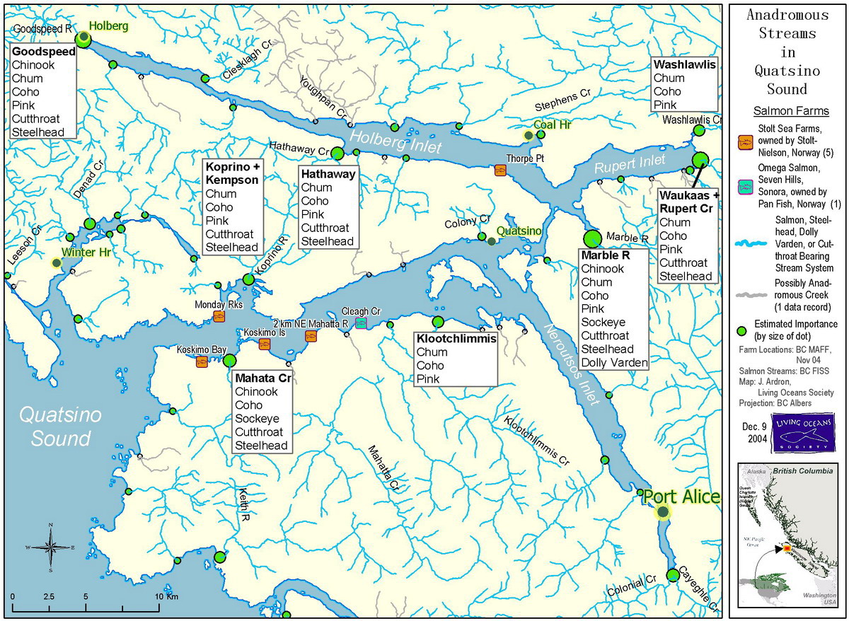
Fish farms, Quatsino Sound. (Click to enlarge) | |||||

Killed humpback whale at Coal Harbour, 1948. Some six km from the Quatsino Reserve at Coal Harbour is the notorious Island Copper Mine (right). Owned by the American company Utah International, it operated from 1971 to 1986. Waste from its open pit was in theory contained by a slurry wall but the longterm ecological impact of the mine has never been adequately studied. A scientific report links tailings from the mine to arsenic and copper residues in local waterbirds: Contamination and Toxicology (1992). Also worrisome are recent scientific reports that due to their concentrated consumption of seafood, BC killer whales are one of the world's most chemically contaminated species. |
Coal Harbour, on Rupert Arm of Quatsino Sound, was founded by British coal miners in the late 1880s. A commercial whale processing industry operated here from 1947 to 1967. In 1948, a fifty ton humpback whale (left) was killed by Wilhelm Ingabritsen, the Icelandic owner of the Western Whaling Corporation. Today the humpbacks which had made Quatsino Sound their home for millenia under aboriginal stewardship have vanished. In 1972, to reduce its operating costs, the government set up the "Quatsino Subdivision Indian Reserve No. 18" near Coal Harbour and forced the inhabitants of Xwatis to relocate there. Island Copper Mine, Quatsino Territory. |
|||||

Traditional kayak tour of Quatsino Sound, 1996. |
Coastal First Nations people rely primarily on foods harvested from the sea. Kwakiutl member Tom Child has done graduate research at the University of Victoria on how traditional fish rich aboriginal diets are impacted by industrial waste and toxic chemical residues such as PCBs, PBDEs, and mercury. Reference: Traditional Seafoods of Vancouver Island: Balancing Health Benefits with Pollution Risks (2008). Quatsino Chief Fran Hunt - Jinnouchi was raised in Xwatis on a traditional diet and worries about the negative effect on native culture if the aboriginal foods become too contaminated to eat: "We're coming to a point of the last vestiges of what defines us" 17 August 2006 (Globe and Mail). Hunt - Jinnouchi is seen taking part in a traditional tour of Quatsino Sound in 1996 (left, standing). In 2007 she was appointed first director of the Office of Indigenous Affairs at the University of Victoria. |
|||||


Source: www.firstnations.eu Printed:
Copyright: All Rights Reserved. Researched, written, compiled, formatted, hyperlinked and encoded by Dr. Karen Wonders. Images and intellectual property rights reside with the credited owner. Commercial transmission and/or reproduction requires written permission. Use for educational and research purposes requires proper citation.